
Places That Explain How the Netherlands Created Land From Water 🌊
Much of the Netherlands' landscape has a story hidden beneath it. 🌊 Some fields were once lakes, some roads cross former seabeds, and some villages stand on land that people had to work for centuries to keep dry.
From traditional windmills to enormous modern dikes, these places reveal how the Dutch changed their landscape using engineering, planning and a deep understanding of water. 🇳🇱
1. 🌬️ Kinderdijk: The Windmills That Helped Keep the Land Dry
📍 Where: Nederwaard 1, 2961 AS Kinderdijk, Netherlands
Kinderdijk is one of the most famous places to understand Dutch water management. Its 19 historic windmills stand beside canals and low-lying fields, showing how people used wind power to help move water out of the polders.
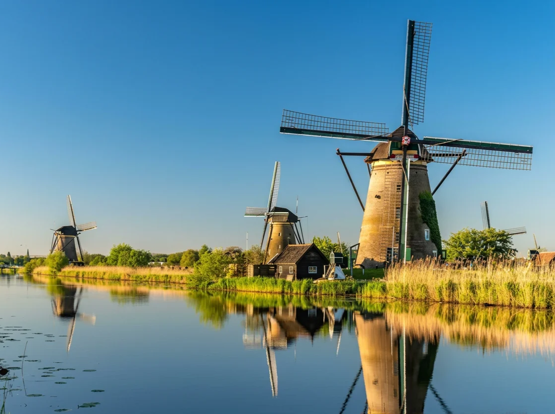
The windmills were part of a wider system of dikes, drainage channels and reservoirs. Together, these structures helped protect the surrounding land from flooding.
What makes it special:
🌬️ See 19 historic windmills in one landscape.
💧 Discover how wind power helped move water.
🌾 Walk beside canals and reclaimed fields.
🏛️ Explore a UNESCO World Heritage Site.
2. 🌾 Beemster Polder: A Lake Turned Into Farmland
📍 Where: Middenbeemster, 1462 JL, Netherlands
Beemster was once a lake. In 1612, it was drained to create new land for farming and settlement. Engineers enclosed the lake with a dike and used windmills to pump out the water. After the lake disappeared, roads, canals and fields were carefully laid out across the reclaimed land.
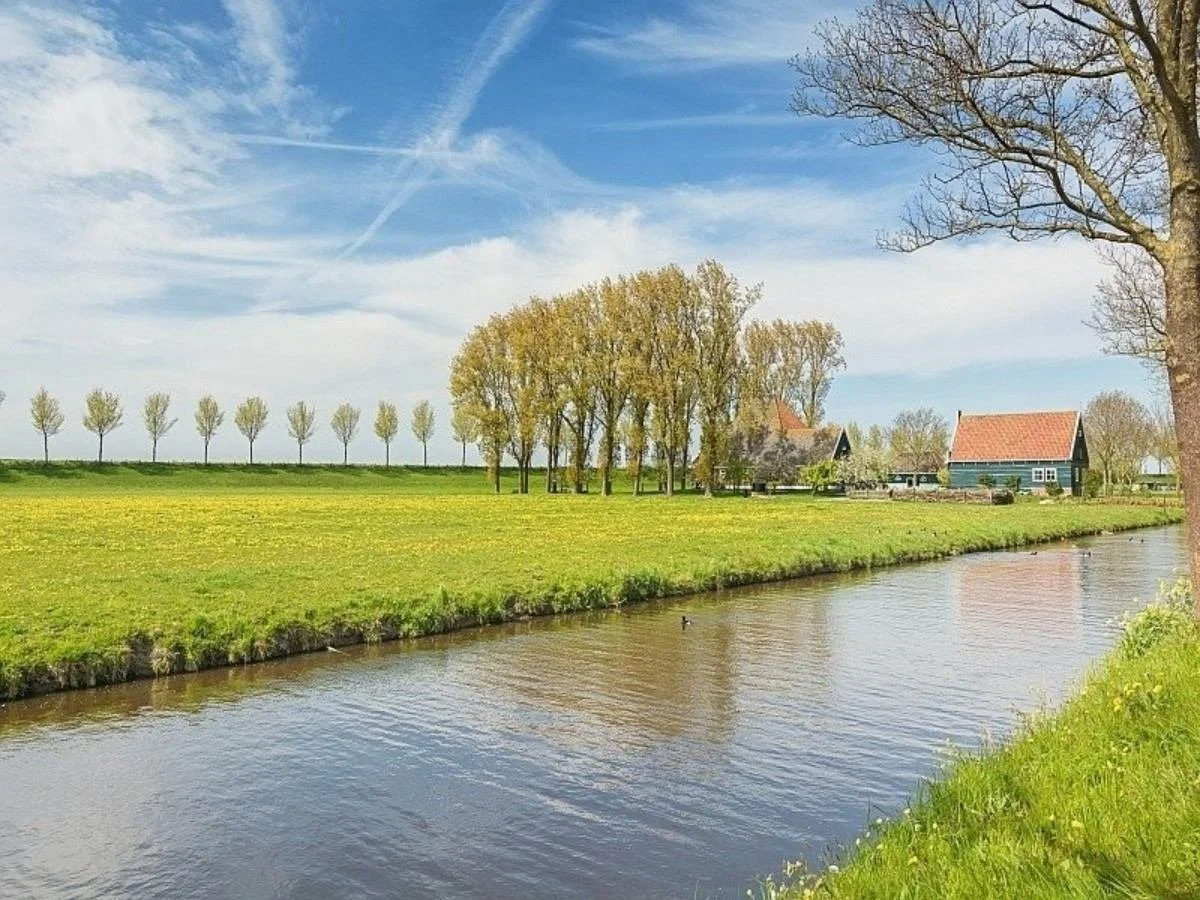
Look at Beemster from above and you will notice something unusual: the fields and roads form a remarkably organised geometric pattern.
What makes it special:
🌊 Discover land reclaimed from a lake.
📐 Notice the straight roads and rectangular fields.
🚜 See how reclaimed land became farmland.
🏛️ Explore a UNESCO World Heritage landscape.
3. ⚙️ Schermerhorn: The Windmills Behind a Major Reclamation Project
📍 Where: Noordervaart 2, 1636 VL Schermerhorn, Netherlands
The Dutch did not drain lakes with just one windmill. In the seventeenth century, large groups of windmills worked together to remove water from entire lakes. Schermerhorn tells this story through its historic museum windmill. The Schermer Lake was drained between 1633 and 1635 using a system of 52 windmills.
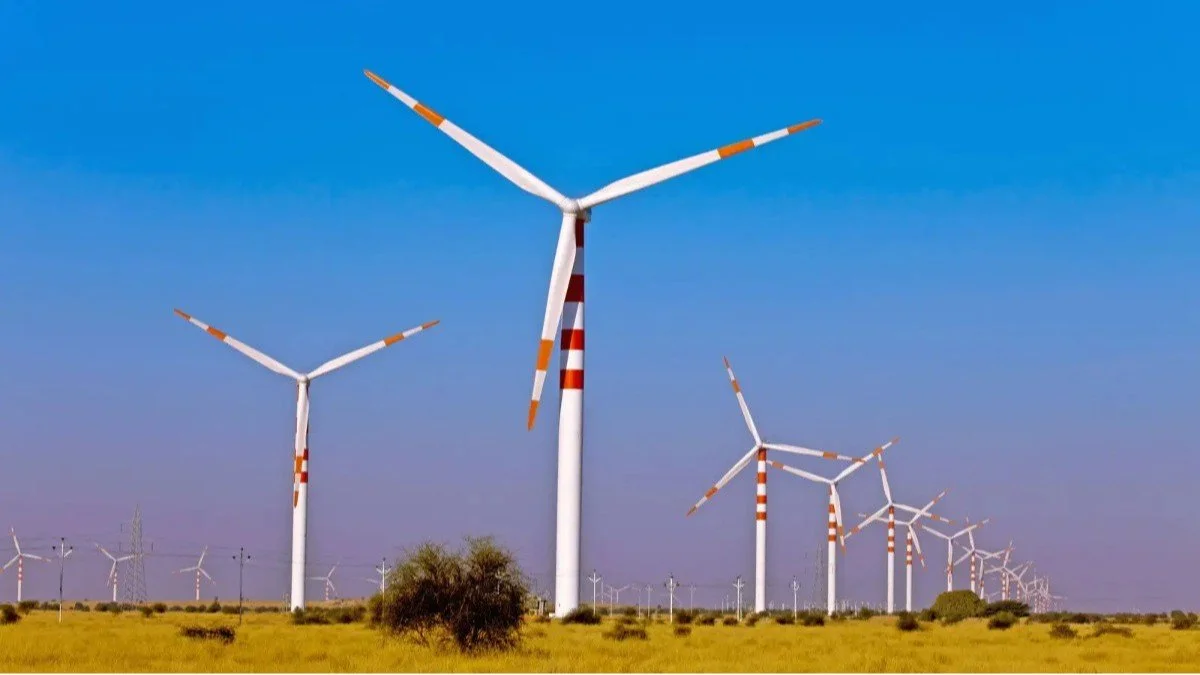
Inside the mill, visitors can discover how the machinery worked and how millers lived while helping maintain the surrounding landscape.
What makes it special:
⚙️ Explore a historic polder windmill.
🌊 Learn how 52 windmills helped drain Schermer Lake.
🏡 Discover the living conditions of traditional millers.
🌾 See the flat countryside created through reclamation.
4. 🧱 Afsluitdijk: The Dike That Changed the Map
📍 Where: Afsluitdijk, between Den Oever and Kornwerderzand, Netherlands
Imagine driving along a long road with water stretching out on both sides. That is the experience of the Afsluitdijk, a massive dike completed in 1932. It separated the former Zuiderzee from the Wadden Sea and created the IJsselmeer as a more controlled body of water. The project helped protect surrounding areas from flooding and made later land-reclamation projects possible.
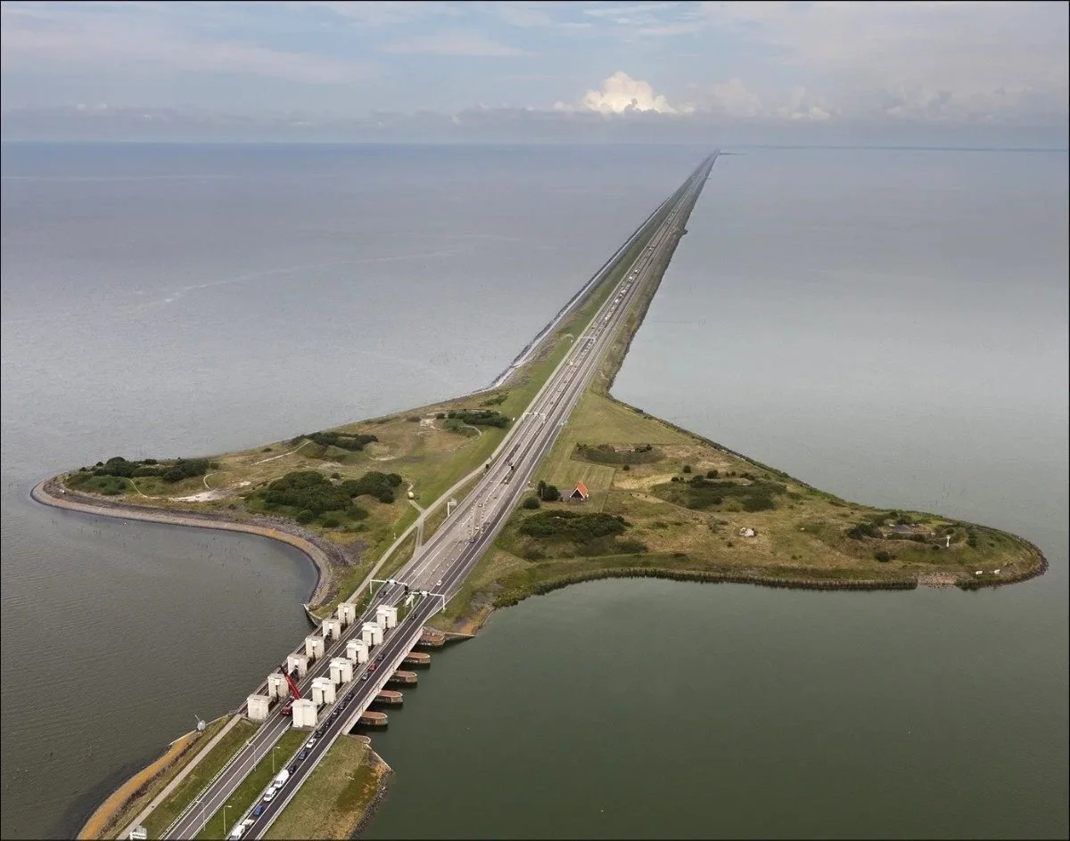
This is not simply a wall against the sea. It is an engineering project that changed the geography of an entire region.
What makes it special:
🧱 Experience a dike approximately 32 kilometres long.
🌊 See water on both sides of the structure.
🚧 Discover the role of locks and water-control systems.
🏗️ Understand how the project enabled further reclamation.
5. 🏙️ Flevoland: A Province Built on Reclaimed Land
📍 Where: Lelystad, Flevoland, Netherlands
Flevoland is one of the clearest examples of modern Dutch land reclamation. Much of the province was created from areas of the former Zuiderzee. After water was enclosed by dikes and pumped away, new land became available for farms, roads, villages and towns. Unlike many historic Dutch cities, parts of Flevoland were planned with broad roads and carefully organised settlements.
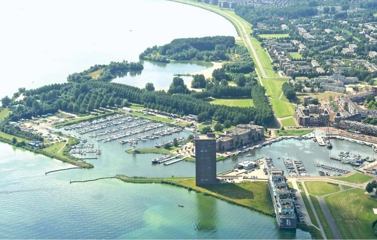
It is fascinating to think that land where people now live and work was once beneath the water.
What makes it special:
🗺️ Explore a province shaped by land reclamation.
🚜 See farmland built on the former seabed.
🏘️ Discover carefully planned towns and settlements.
🌱 Observe how agriculture and nature share the landscape.
6. 🏝️ Schokland: The Former Island Surrounded by Fields
📍 Where: Middelbuurt 3, 8319 AB Schokland, Netherlands
Schokland was once an island in the Zuiderzee. Rising water levels and flooding made life increasingly difficult for its residents, and the remaining inhabitants were evacuated in 1859. Later, the surrounding waters were drained, leaving Schokland as a historic island surrounded by reclaimed land.
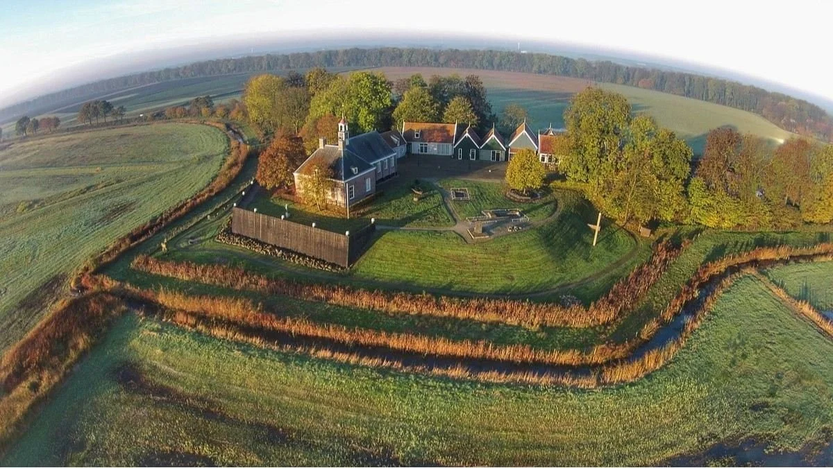
Today, the contrast is remarkable: a place once surrounded by water now sits within a landscape of fields and roads. It shows how reclamation can change not only the land but also the identity of a place.
🏝️ Discover a former island now surrounded by land.
🏛️ Explore a UNESCO World Heritage Site.
🌊 Learn how water shaped local communities.
🌾 See the contrast between historic high ground and the surrounding polder.
7. 🚂 Woudagemaal: The Giant Steam-Powered Pumping Station
📍 Where: Gemaalweg 1a, 8531 PS Lemmer, Netherlands
Windmills were only one stage in the Dutch water-management story. As technology advanced, powerful pumping stations made it possible to move water more efficiently. The Woudagemaal opened in 1920 and is the largest steam-powered pumping station in the world. It was built to help control water levels and protect low-lying areas.
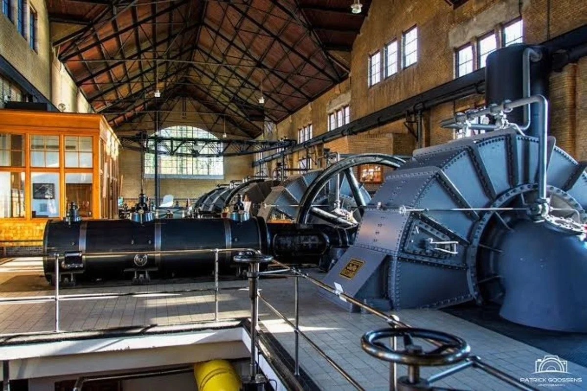
Inside, enormous engines and pipes reveal the scale of the machinery used to manage water. It is a reminder that keeping reclaimed land dry requires more than creating it in the first place.
What makes it special:
⚙️ Discover enormous historic steam engines.
💧 Learn how pumping stations manage water levels.
🏭 Explore a landmark of Dutch industrial engineering.
🏛️ Visit a UNESCO World Heritage Site.
8. 🚜 Noordoostpolder: Fields That Were Once Underwater
📍 Where: Emmeloord, 8302 AB, Flevoland, Netherlands
The Noordoostpolder was officially drained in 1942, transforming part of the former Zuiderzee into usable land. The process involved enclosing the area with dikes and pumping away the water. Roads, farms, villages and drainage channels were then developed across the new landscape.
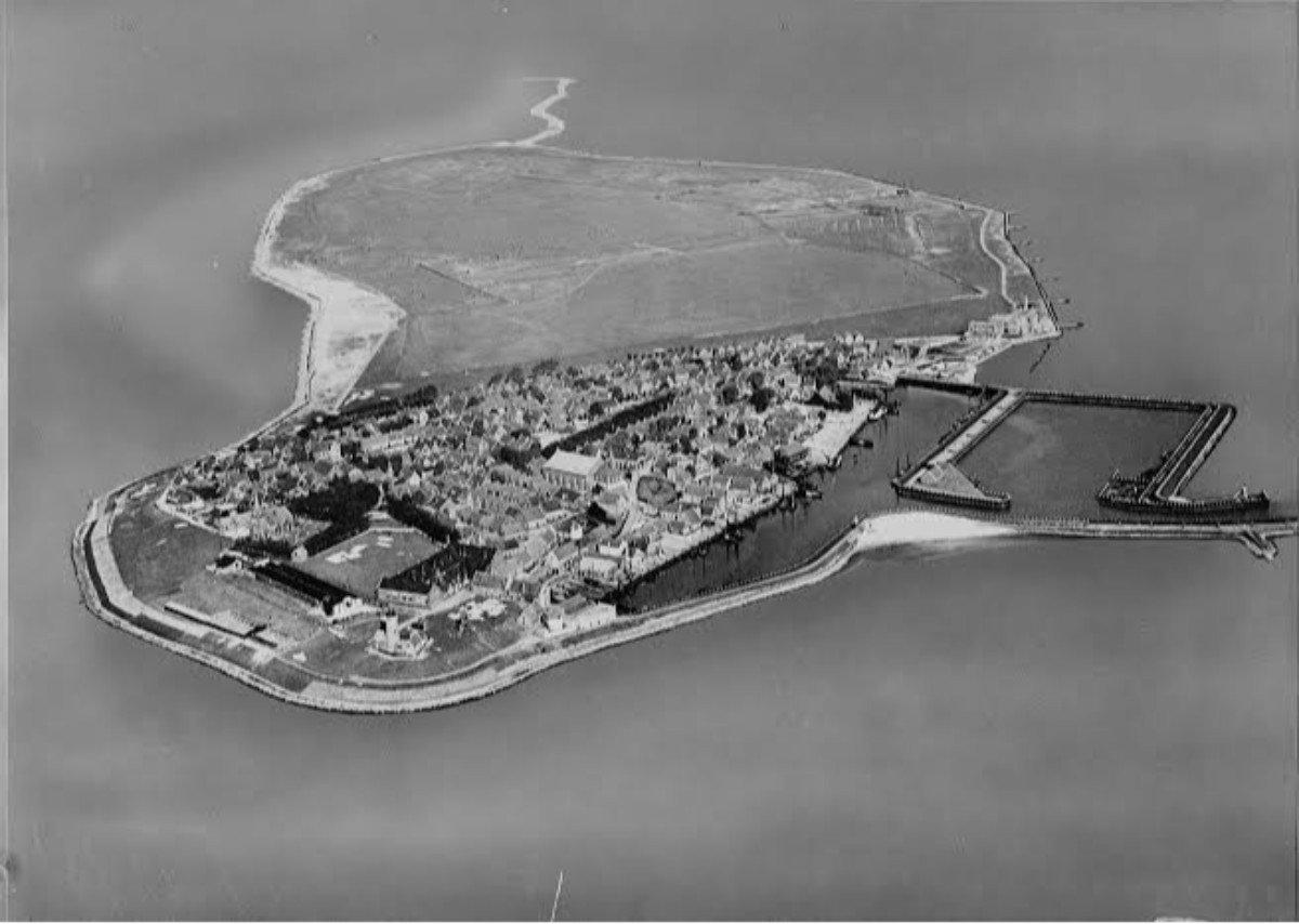
Today, the region looks like ordinary Dutch countryside. Yet beneath the fields lies a former seabed, and water levels still need to be carefully managed.
What makes it special:
🚜 Explore land reclaimed from the former Zuiderzee.
💧 Learn how dikes and pumping stations made the area habitable.
🗺️ Notice the organised pattern of roads and fields.
🌷 Discover a region known for agriculture and seasonal flower fields.
9. 🏺 Zuiderzeemuseum: Life Before the Sea Was Closed Off
📍 Where: Wierdijk 12–22, 1601 LA Enkhuizen, Netherlands
Before the Afsluitdijk was completed, communities around the Zuiderzee depended heavily on fishing, boatbuilding and maritime trade. The Zuiderzeemuseum preserves the history of these communities through traditional buildings, historic objects and exhibitions about life beside the water.
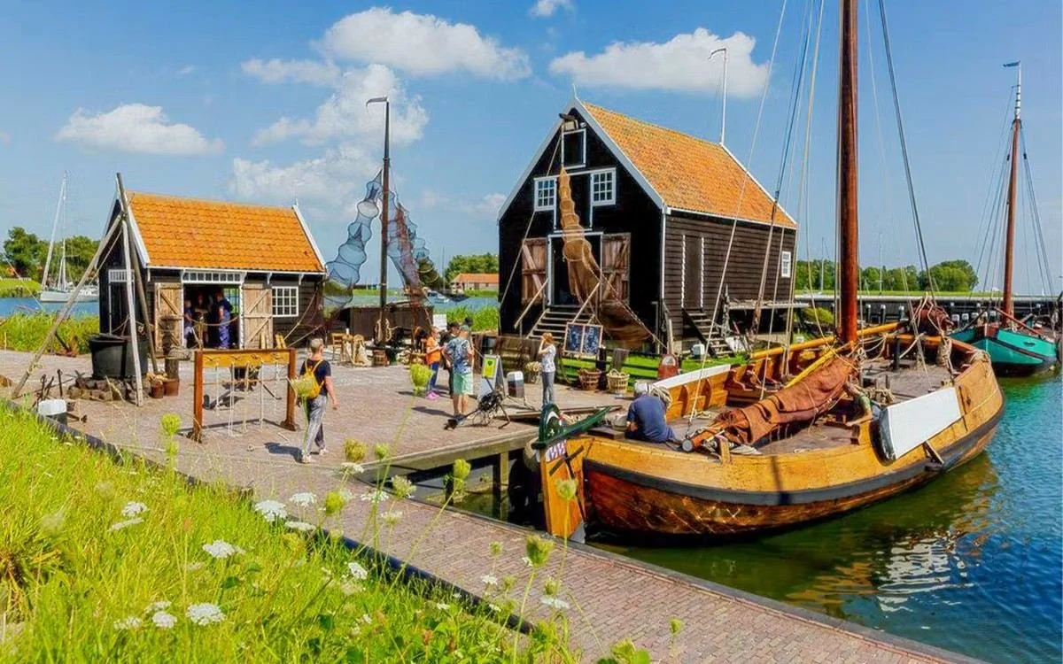
This place adds a human story to the engineering achievements. The construction of dikes and the transformation of the Zuiderzee changed not only the geography but also the livelihoods and traditions of the people who lived there.
What makes it special:
🏘️ Discover traditional Dutch buildings and everyday life.
🎣 Learn about fishing communities around the former Zuiderzee.
⚓ Explore maritime history and boatbuilding traditions.
🌊 Understand how major water projects changed local life.
10. 🌳 Waterloopbos: Where Engineers Tested Their Water Projects
📍 Where: Voorsterweg 34, 8316 PT Marknesse, Netherlands
Before engineers built major water projects, they needed to understand how water behaved. Waterloopbos was used for hydraulic research, with physical models helping engineers study waves, currents, harbours and coastal structures.
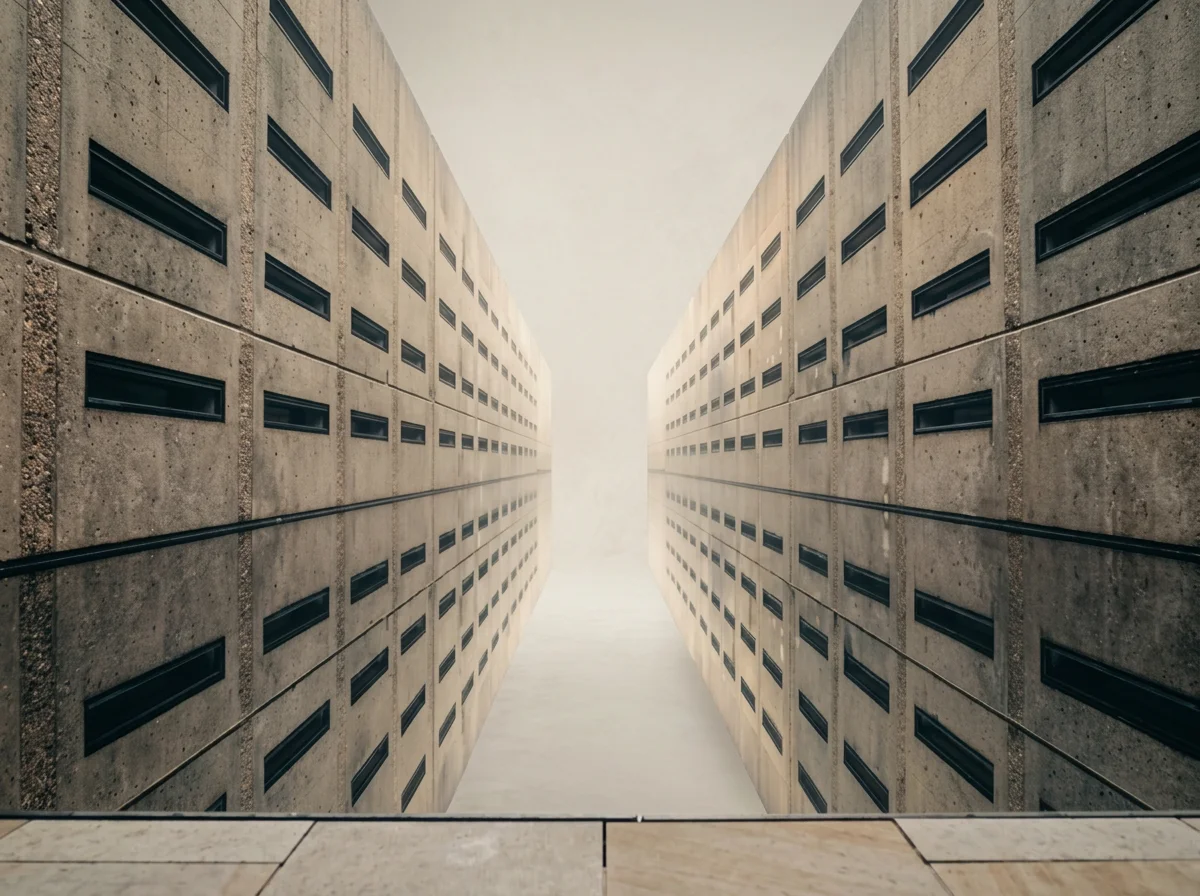
Today, historic channels and concrete structures sit among trees and greenery. The site offers a different perspective on Dutch water engineering: it reveals the experiments and planning behind the structures that changed the country.
What makes it special:
🏗️ Discover historic water-engineering models.
🌊 Learn how engineers studied waves and currents.
🌳 Explore a woodland filled with traces of scientific research.
🧠 Understand the testing behind major engineering projects.
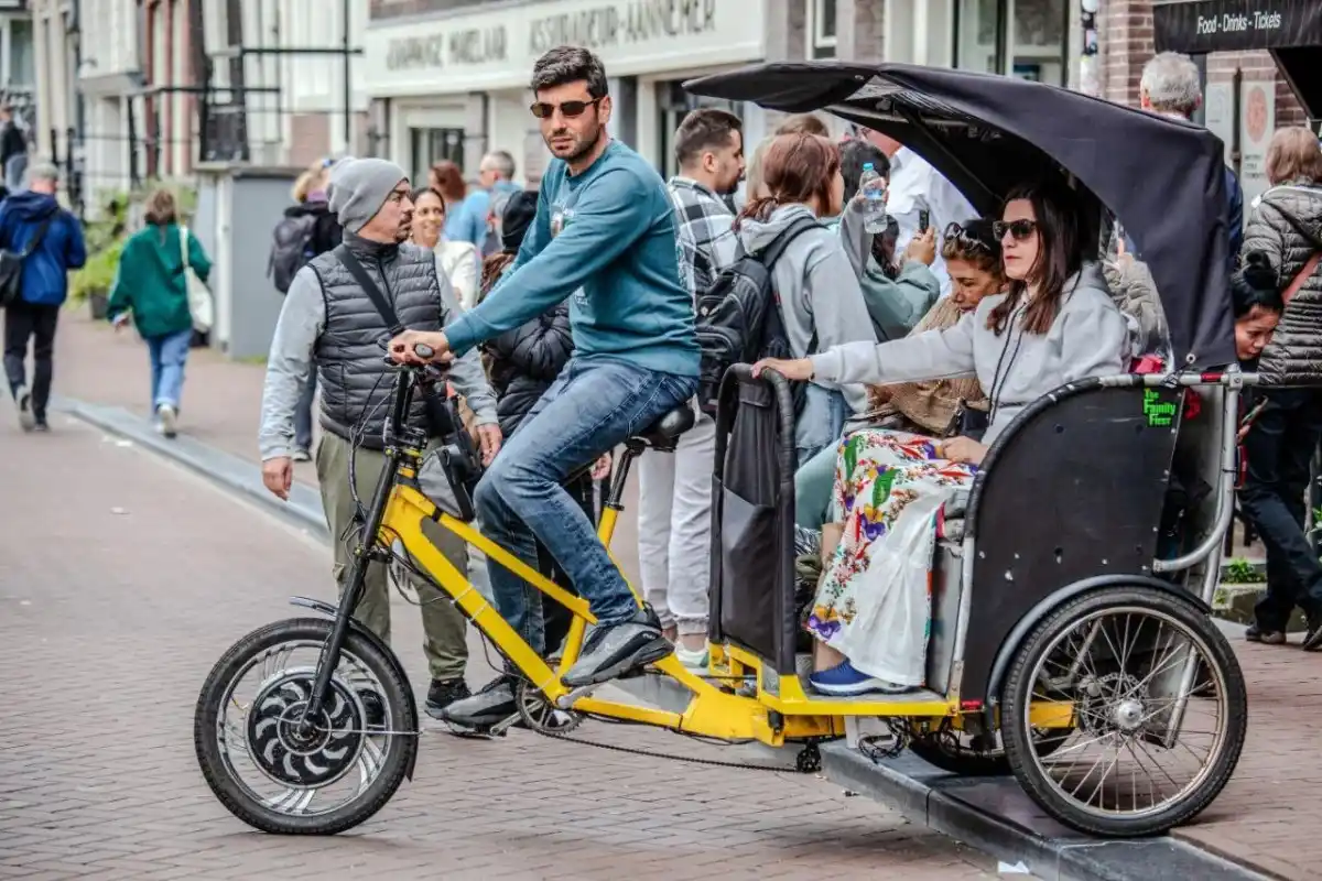
Explore Amsterdam by Electric Pedicab
Private rickshaw tours · From €12 · Local guides · Mon–Sun 8AM–6PM
Before heading out on your day trip, explore Amsterdam the fun way — by private electric pedicab. Cruise through canals, Jordaan, and hidden streets with a friendly local guide. No crowded trams, no tired legs — just a relaxed Amsterdam experience.